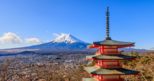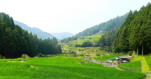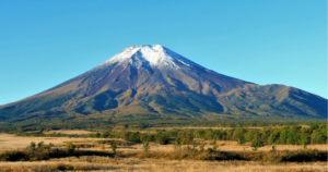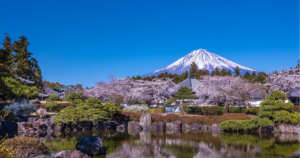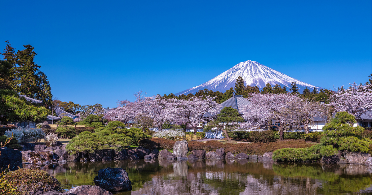
When Mount Fuji comes into view on a journey, many of us instinctively point a camera towards the summit. For people who live at its foot, however, Fuji is part of the background to commuting, school, farm work, and shopping long before it becomes a subject for a photograph.
While researching this essay, I was especially struck by the simple words of local residents: Mount Fuji can be seen from almost anywhere; it helps them find their bearings; the area has plentiful water.
From those everyday observations, the essay follows the 'farm bird', a bird-shaped patch of lingering snow that once signalled the farming season, as well as the spring water that flows underground to support homes and industry, the tea fields and textiles shaped by volcanic land, and the preparations made for a future eruption.
Lowering our gaze from the famous summit reveals an ordinary life built in constant conversation with the mountain. I hope you will read this essay as though we were walking together through the communities that live with Mount Fuji every day.
The Fuji Beyond the Postcard
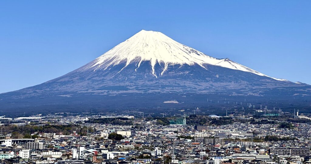
For a visitor, Mount Fuji is a mountain to seek out. We travel to a lakeside viewpoint, wait for cloud to lift, and try to fit the summit into a photograph. For people living around its base, however, there must be a profound difference between spending a day looking for Fuji and simply noticing Fuji while getting on with the day. It appears while washing is hung outside, on the way to a station, through a classroom or office window, or beyond an ordinary junction on the journey home. It is not always the destination. More often, it stands behind whatever else needs to be done.
While researching this essay, I came across the record of a residents' workshop held by Fujinomiya City as it prepared a plan for preserving and using local cultural heritage. Asked what was good about their city, participants offered wonderfully direct observations: Mount Fuji can be seen from almost anywhere; it makes direction easy to understand; the city has abundant, clean, good-tasting water. These short remarks seemed to reveal more about living with Fuji than a list of superlatives ever could. The mountain is a source of pride, but it is also a compass and part of the story behind the water from the tap.
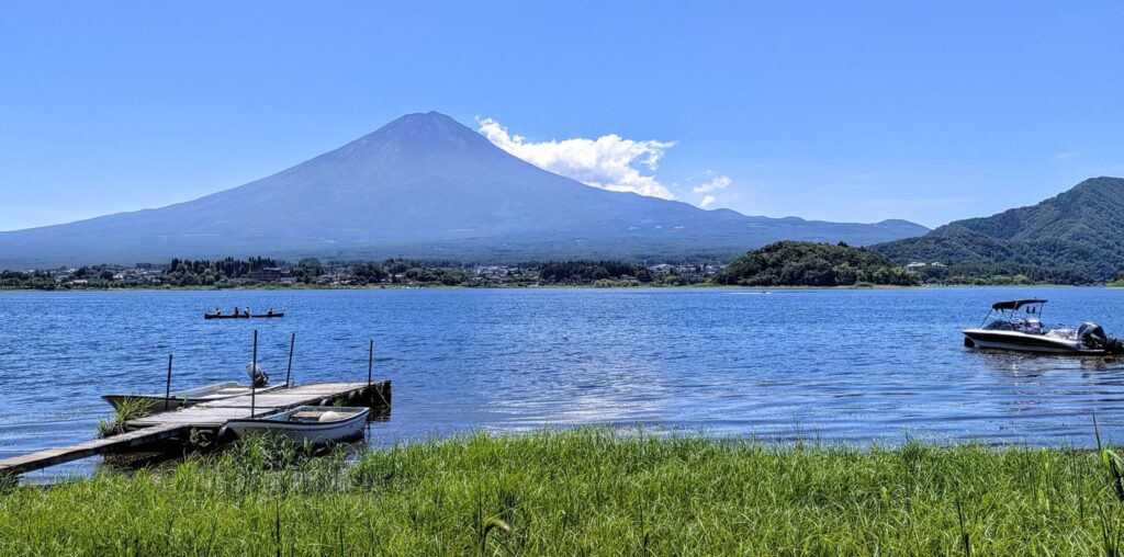
That does not mean every street offers a perfect postcard view every day. Buildings interrupt the line of sight. In the rainy season and summer, cloud often hides the mountain, and a summit visible at breakfast may have disappeared by noon. Nor is the mountain identical from every community. Its ridgelines look different from Yamanashi and Shizuoka; the Hoei crater dominates some views, while elsewhere the long spread of the lower slopes is more striking. There is no single town beneath Fuji, but many local versions of everyday life around one enormous mountain.
Tourism selects the most beautiful moment. Life continues through days of rain, heavy cloud, and little snow. Residents therefore encounter not one completed image but a mountain that changes a little each day. Sometimes its familiarity makes it easy to ignore; sometimes an unexpected evening light stops a person in the street. The special and the ordinary are not opposites. When the same presence is encountered over years, a sense of attachment can gather quietly inside repetition.
A Mountain That Marks the Day and the Season
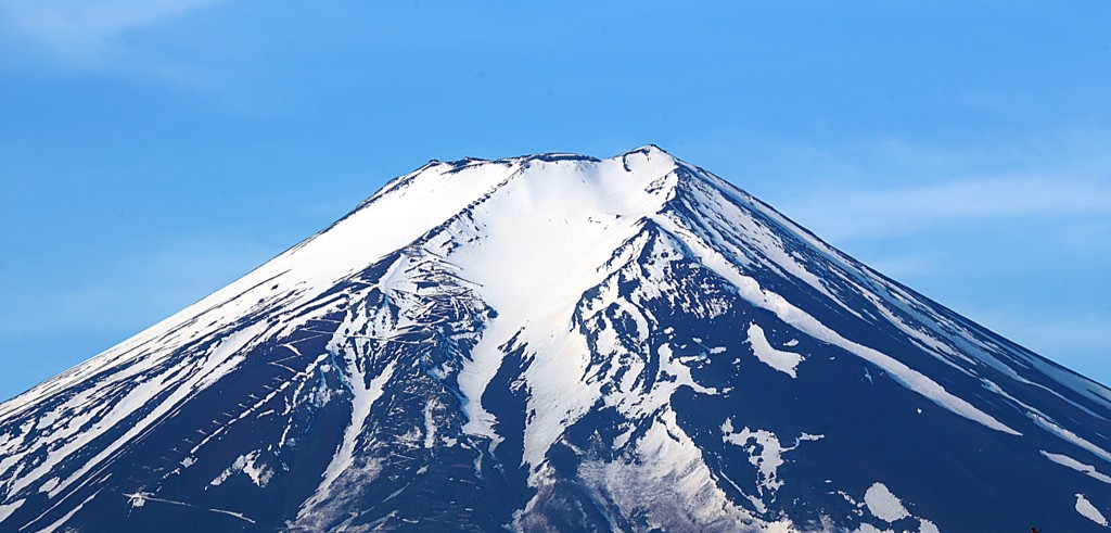
Long before precise forecasts and printed calendars, familiar mountains helped communities read weather and season. Fuji's cloud, snow cover, and morning or evening colour still encourage people to look closely at the sky. No traditional saying can replace meteorology, and cloud shapes do not offer infallible predictions. Yet the habit of looking at the mountain before going into a field or setting out on a road keeps attention fixed on natural change. The first snowcap becomes local news because the whitening summit is connected to the season felt below.
One of the clearest examples is the no-tori, or 'farm bird', seen from the Fujiyoshida side. As spring advances, a patch of remaining snow around the seventh and eighth stations takes on the shape of a bird. Fujiyoshida City's account explains that its appearance once told farmers when to place seed rice in the nursery bed; the growth of the seedlings then helped determine the time for transplanting. Written references to the snow figure survive from the early nineteenth century. A pattern high on the mountain functioned as part of an agricultural calendar.
Farming methods and schedules have changed, so the no-tori no longer controls work as it once did. Even so, Fujiyoshida continues to announce its appearance. In 2026, warm April weather and rain accelerated the thaw, and the city recorded the bird on 17 April, earlier than usual. Records from recent years range from early April to early June. It is the same expected shape in the same part of the mountain, yet each appearance carries information about a different winter and spring.
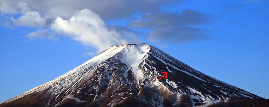
Reading these records made me realise that watching a mountain was once a practical skill. People compared natural signs over many years and linked observation to the organisation of work. Modern forecasts and agricultural science are far more precise, but the annual conversation has not become meaningless. Saying that the bird is early, or that the snow is sparse, turns a broad environmental change into something visible on the familiar slope. It gives a community an image through which to notice the year together.
Fuji also belongs to daily life when it cannot be seen. Because everyone knows the mountain remains behind the cloud, its absence becomes part of the weather. For someone who lives within its view, Fuji may be less a celebrated attraction than an immense surface on which the atmosphere reveals itself. Looking at the mountain is not simply a way to confirm a supposedly timeless symbol. It is a way of paying attention to a day that never repeats itself exactly.
When the Invisible Mountain Becomes Water
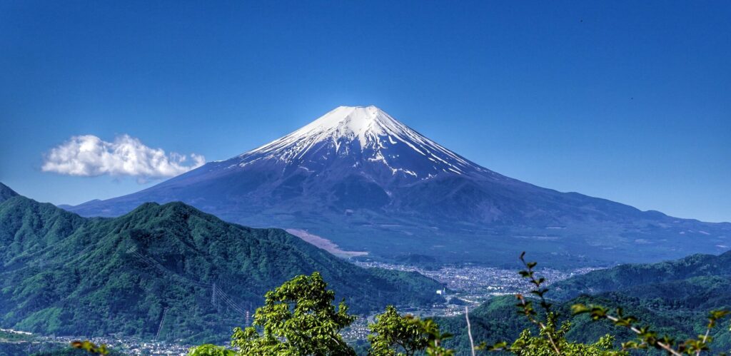
The relationship between Fuji and daily life does not exist only when people look upwards. Some of its most important connections begin where the mountain disappears from sight. Rain and melting snow soak into porous layers of volcanic ash and lava, then travel slowly underground. Water returns to the surface around the edges of old lava flows and in other spring zones: Oshino Hakkai to the north, Wakutama Pond to the south, Shiraito Falls to the west, and the springs around the Kakita River to the east. Sites far apart on a map are linked through the body of the same mountain.
Shizuoka Prefecture notes that Fuji's groundwater and springs serve municipal, agricultural, and industrial needs. The Kakita River springs alone discharge about 1.1 million tonnes of water a day, with a temperature that remains close to 15 degrees Celsius throughout the year. Water from this system is supplied for drinking across neighbouring municipalities and is also used by farms and industry. Once we follow the clear water beyond the photogenic pools and imagine it branching towards homes, factories, and fields, the mountain's human footprint becomes much wider than its visible slopes.
Abundance does not mean that water reaches every place without human effort. Volcanic ground can absorb rain so readily that surface rivers are scarce in some areas. Communities opened channels from reliable springs, divided the flow, and developed dry land. Fujinomiya's cultural-heritage plan treats irrigation works, new-field development, and agriculture and industry adapted to volcanic soils as central parts of the history of living with Fuji. The mountain offered possibilities, but people still had to locate, carry, share, and protect the water before it could sustain a settlement.
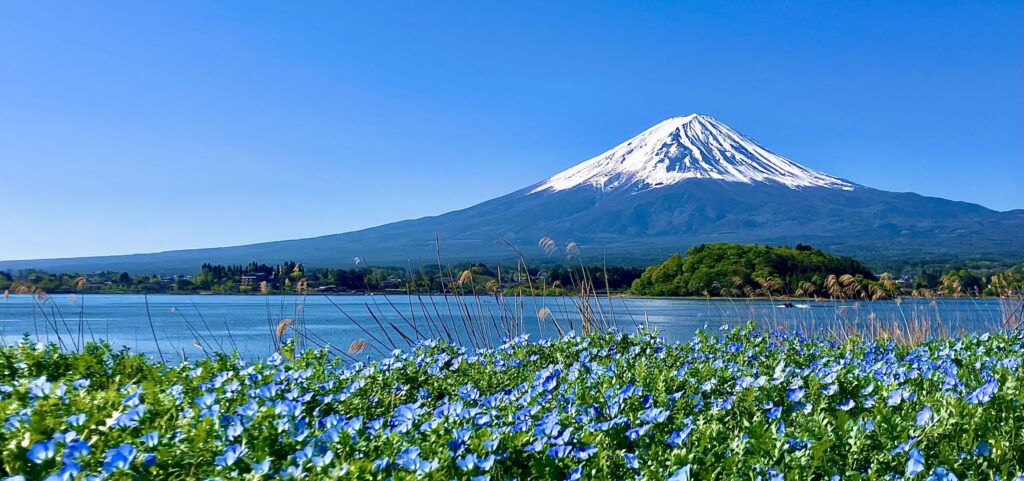
Management remains essential. Shizuoka has monitored spring discharge in its eastern region since the late 1950s and early 1960s because many communities depend on these sources. Fujiyoshida regulates groundwater extraction to preserve the resource for the future. A spring that pours out an astonishing volume can look inexhaustible, but groundwater depends on recharge, land use, forests, and the balance of extraction. The more generous the visible flow, the easier it is to forget the invisible system that must be cared for.
There is no outline of Mount Fuji in a glass of water, an irrigation channel, or the process of making food and manufactured goods. Yet the water carries a journey: rain or snow fell on the mountain, entered the ground, passed through volcanic layers, and returned after years or decades. Living with Fuji is not only a matter of seeing the mountain every day. It can also mean using a part of the unseen mountain in the most ordinary acts of life.
Work Shaped by Volcanic Land
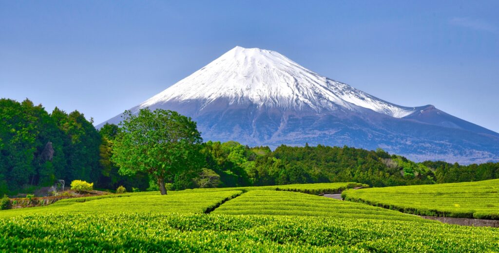
Many of the landscapes admired around Mount Fuji are not products of nature alone. At Obuchi Sasaba in Fuji City, bright rows of tea stretch towards the mountain and attract photographers from across Japan. Those lines of green are not scenery planted for a camera. They are working fields maintained by farmers. New leaves in May, the carefully clipped rows, and the tracks between them all belong to production. The view that visitors call characteristically Japanese survives because people continue to make a living there.
On the cooler northern foothills, the Fuji and eastern Yamanashi region supports highland vegetables, flowers, and dairy farming, as well as farm shops and visitor-oriented agriculture. Around the Asagiri Plateau to the south-west, livestock and dairy landscapes are prominent. Fujinomiya describes spring water and other local resources as supporting agriculture, trout farming, manufacturing, tourism, and additional industries. One mountain produces many local economies because elevation, aspect, temperature, soil, and the emergence of water differ from place to place.
Volcanic land has never offered blessings without constraints. Water disappears easily underground in some places; winters are severe on the uplands; lava and ash complicate cultivation. Communities selected crops and trades that suited those conditions, built the necessary channels, and developed work beyond farming. Fujiyoshida's history as a textile town, for example, is associated both with clean spring water used in dyeing and with a difficult agricultural environment in which sericulture and weaving offered other ways to earn a living. Natural conditions were not simply advantages or disadvantages. They formed the terms to which local ingenuity had to respond.
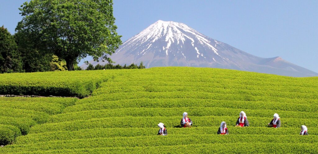
A visitor may see tea gardens, grazing land, irrigation channels, or old factory buildings mainly as foregrounds for Fuji. For a community, they are places of income, skill, and family history. Preserving a Fuji landscape therefore involves more than removing cables or controlling signs in front of a famous view. If farmers cannot maintain fields, if water systems are neglected, or if industrial knowledge has no successor, the landscape that expresses the character of the foothills will also fade.
The phrase 'beautiful scenery' can hide labour. Between the neat lines of a tea field lie decisions about weather, growth, and harvest. Behind a piece of locally woven fabric lie water, technique, and the sound of machinery. What gives warmth to a landscape around Fuji is not the cone of the mountain alone. It is also the ordinary work, usually absent from photographs, that has continued beneath it.
Protecting Life Beside an Active Volcano
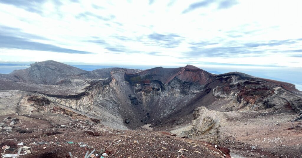
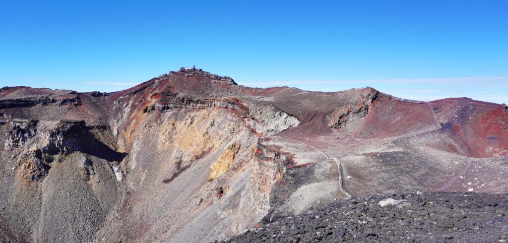
No account of daily life around Fuji is complete if it speaks only of beauty and gifts. Mount Fuji remains an active volcano. The Japan Meteorological Agency records that the large Hoei eruption began on its south-eastern flank in 1707 and spread enormous quantities of ash and other material across a wide area. A long period without eruption does not turn a volcano into something else. The lava layers that carry groundwater, the broad foothills, and the soils on which communities work were all formed through repeated activity. Benefit and danger do not come from separate mountains; they share one geological history.
This is why hazard maps, evacuation plans, exercises, and facility-specific procedures belong to the administrative fabric of the foothills. The Mount Fuji hazard map revised in 2021 used new research to show that lava and other volcanic phenomena might reach some urban areas more quickly and extend farther than earlier assumptions suggested. The Basic Plan for Evacuation from Mount Fuji, published in 2023, places the protection of life first while also giving the greatest possible consideration to protecting livelihoods.
That second phrase matters. Evacuation is designed to save people, but a community also contains homes, schools, hospitals, farms, factories, hotels, and the web of work that supports them. Closing an unnecessarily large area too early creates one kind of harm; underestimating danger creates another. Deciding who should move, when, and where amid volcanic uncertainty is neither a refusal to live near the mountain nor an excuse to forget the risk. It is practical knowledge required to continue living there.
At the same time, local authorities work to preserve the everyday experience of seeing Fuji. Fujiyoshida's landscape plan covers urban and rural settlements, satoyama, and the lower mountain, while Fujinomiya identifies viewpoints and seeks to protect scenery. What is being conserved is not one isolated postcard. Homes, fields, woods, waterways, streets, human activity, and the mountain behind them form the landscape together. The aim is to pass on a relationship between mountain and town, not simply an unobstructed cone.
As I researched this essay, I came to feel that Fuji's special character is not located outside ordinary life. It lies in using the mountain to find direction, reading the season in remaining snow, drawing on water that has passed beneath the ground, continuing work adapted to volcanic land, and preparing to move when danger demands it. None of these actions is likely to dominate a tourist brochure. Together, however, they turn Mount Fuji from a backdrop into part of life.
A traveller's encounter with Fuji may last only a few hours, while life beneath it continues through clear days and cloudy ones alike. The next time I walk through a foothill town, I would like to look beyond the summit towards a roadside channel, the rows of a field, an old workshop, or an evacuation sign. There, as much as at a famous viewpoint, is the Japan that lives with Mount Fuji. To walk where an extraordinary mountain overlaps with unnamed daily routines is to understand the place more deeply than a photograph alone allows.
Final Thoughts
What I came to understand while researching life around Mount Fuji is that an extraordinary landscape is not created only by extraordinary moments.
It is sustained by people tending rows of crops, caring for springs, keeping looms running and skills alive, or opening a hazard map to think through an evacuation.
Each task is easy to overlook in a photograph, yet together they support the distinctive landscape and daily life of Fuji's foothills.
Even on cloudy days when the mountain disappears from view, it remains present through underground water and the memories held in the land.
The next time you walk through a town beneath Fuji, try looking beyond the search for a perfect photograph.
Notice the waterways, fields, small workshops, and roadside evacuation signs.
When we imagine the lives and time of the people who call this place home, Mount Fuji becomes more than a distant symbol. It becomes a familiar mountain whose blessings and responsibilities are shared.
To me, Fuji standing beyond these unnamed, everyday scenes is one of the Japanese landscapes most worth carrying into the future.
The Japanese version of this article is here.↓↓↓